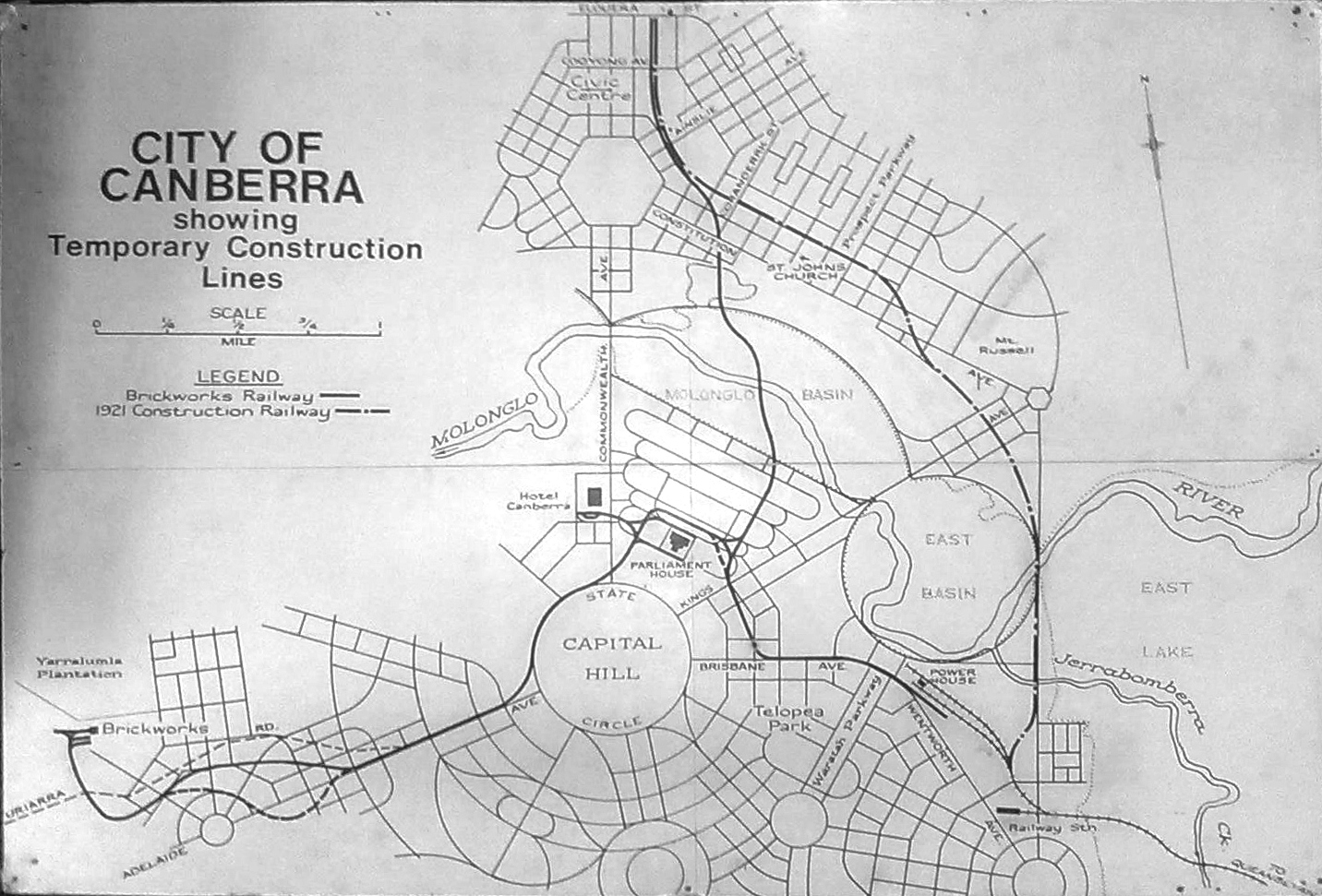
Walter Burley Griffin won the international competition for an overall design of Australia’s national capital, and was Director of Planning and Construction for the federal capital until 1921, when he was (controversially) sacked.
His detailed city and suburban plans had been developed as early as 1916, and remained mostly intact after his departure. In 1927, a map was published commercially as part of a guide for visitors attending the opening of Parliament House (Old Parliament House), with the name “Westridge” applying to the area of Yarralumla and Deakin. The whole Canberra map can be viewed online from the National Library’s great collection.
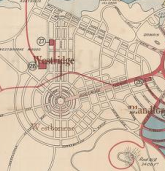 The elements actually existing in 1927 are marked in red. In Deakin, only the Prime Minister’s Lodge, National Circuit and part of Adelaide Avenue were built by then. The old Uriarra Road, now renamed Cotter Road, wanders up through Yarralumla near the line of Weston Street and Hampton Circuit, to join Adelaide Avenue where it peters out about where Robe Street, Deakin faces Adelaide Avenue.
Griffin planned that Adelaide Avenue would terminate in a great cartwheel of circular residential streets, covering a large portion of Deakin West, of Yarralumla’s southwest corner, and of the Curtin horse paddocks along Yarra Glen as far as the creek. The cartwheel’s hub is at at the current intersection of Kent/Novar Streets with Adelaide Avenue. Of this proposed residential suburb, only part of Kintore Crescent (Yarralumla) and McCartney Crescent (Deakin) remain where Griffin had drawn his concentric circles, though you could argue that Abbott St, Yarralumla and Gormanston Cres, Deakin also fit that outline. West of Kent St, no shadow remains.
The basic street plan east of Hopetoun Circuit (then called Australasia Circuit) is close to the modern plan, but there are several differences. The Griffin plan had Stonehaven Cres cutting across Latrobe Park to join Gawler Crescent opposite Canberra Girls Grammar School. Later plans added Bedford Street as the northern boundary of Latrobe Park. Much later, the line of Hopetoun Circuit was extended to a new roundabout joining Melbourne Avenue, a re-aligned Mugga Way, and Red Hill drive, forming a southern boundary to Latrobe Park. This extension took the name of Stonehaven Crescent, as the original proposed line of Stonehaven Crescent was never built. It can be seen in the row of tall radiata pine trees that come down from the corner of Melbourne Avenue between the oval and the barbecue area of Latrobe Park.
Griffin’s map shows high-density apartment blocks along both sides of Adelaide Avenue from National Circuit to the Westridge cartwheel. By contrast, in 1919 the Federal Capital Authority was advertising the large 3-acre blocks in Red Hill, bordering Flinders Way and Mugga Way, as “orchard blocks”, with a requirement that they become productive within five years. His notion that Canberra would be a compact, self-sufficient community was soon overtaken by the reality that it would be populated more by public servants and service professionals than by toiling horticulturalists, and his “orchard blocks” are now Canberra’s most expensive mansion blocks.
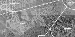 ACTmapi, which is the ACT Government’s interactive mapping service that provides the capacity to analyse ACT spatial data, has released 1955 aerial photos. It can be overlaid with cadastral information and a number of base maps. If you go to the link you can zoom in houses trees and parks as they were then.